
Visual Depiction of Indian Forts and Fortifications
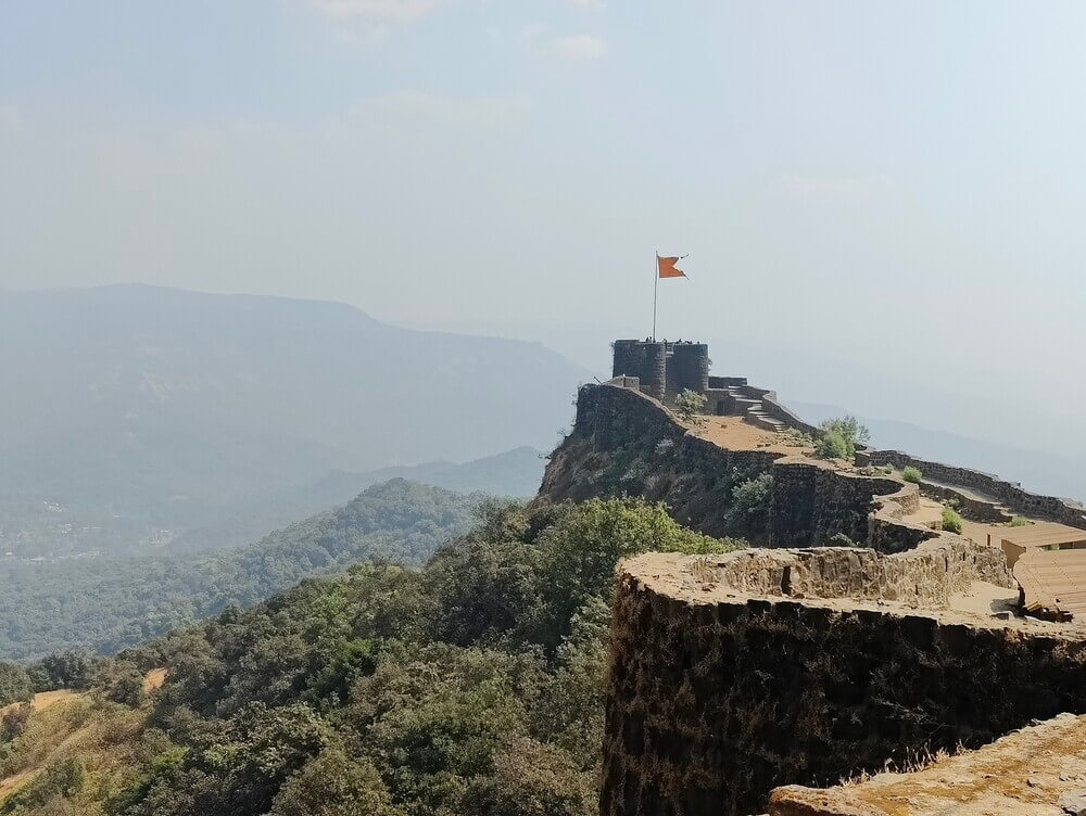
Some of you may have read the recent news that in the UNESCO World Heritage Committee meeting this month, the Maratha military landscapes of India have been inscribed as one of the 26 new World Heritage Sites. This new inscription concerns not a single site, but twelve major fortifications mostly in Maharashtra State, which were built, adapted, or expanded by the Maratha Empire between the late 17th and early 19th centuries. The Committee has noted that the complex defence system formed by these strategically located fortifications ‘played a key role in the Marathas’ rise as a major political and military force’.
In fact, this is not the first time that the cultural and historic values of Indian forts and fortifications have been recognised at an international level. Former inscriptions by UNESCO include the forts in Agra and Delhi, both built by Mughal emperors to mark their power and glory in the capital cities, as well as the hill forts of Rajasthan built by various Rajput rulers. These forts—and indeed many across India—served both military and residential purposes, often incorporating palaces and living quarters for rulers and citizens. As such, the history of forts in India is multifaceted, and can be examined from political, military, architectural and social lenses.
Instead of diving deep into what in itself is a vast and worthy subject to study, for this blogpost I have looked at the visual depiction of Indian forts and fortifications in our collection, and below is a roundup of some interesting selections!
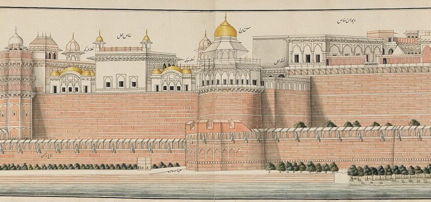
Our Library holds a number of paintings of fort structures across the Indian subcontinent, most notably two watercolours depicting the Red Forts in Agra and Delhi in panorama. The Agra Fort watercolour, measuring over 3 meters wide, is one of the longest paintings in our collection. It captures the magnificence of the fort in full, highlighting its red sandstone ramparts from which it derived its common name ‘Red Fort’, with identifications of the palace and other buildings in Persian script. A close-up of the painting is included below, but this really doesn’t do justice to its minute depiction of the structure.
The James Tod collection (Head Cat. No. 037), with its wide scope of surveying the geography, architecture, natural scenery and religious sites in Rajasthan, also contains several drawings of forts and fortifications in the region. Some drawings from the collection were the subject of the last blogpost written by our President Dr Norbert Peabody on the artistic collaboration that took place under Tod’s supervision. The below drawing from the collection shows the fort and palace of Bundi in Rajasthan. It is an impressive complex of structures built on a steep hill, a prominent feature of fortification in the mountainous part of the region.

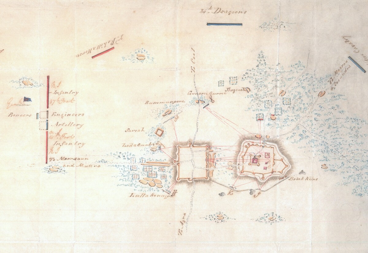
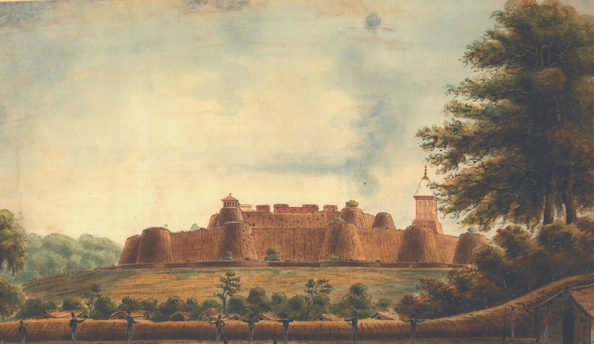
Another collection that has a particular resonance with the new inscription of the Maratha military landscapes is a set of paintings of forts involved in the military conflicts between British forces and local rulers in the early 19th century. One occasion of this is the 3rd Anglo-Maratha War (1817–18), which dealt a huge blow to the Maratha Empire and consolidated British rule over most of the subcontinent. Sir Charles William Doyle (1770–1842), who donated the paintings as part of his extensive gift to the Society, had an active role in the war in his capacity as Military Secretary (1815–20) to the Governor-General Lord Hastings, who was in post from 1813 to 1823. Doyle was responsible for instructing the officers in tactics, which might explain the production of maps and plans of forts. The collection does not feature the newly inscribed forts, but they don’t lack interesting narratives. For example, there is one watercolour of the fort of Hattras in Rajasthan and two drawings of an attack plan relating to what was later known as the Siege of Hattras in 1817, during which the fort was blown up by the British forces. The British forces eventually succeeded in capturing the city, but the ruler of Hattras had a narrow escape.
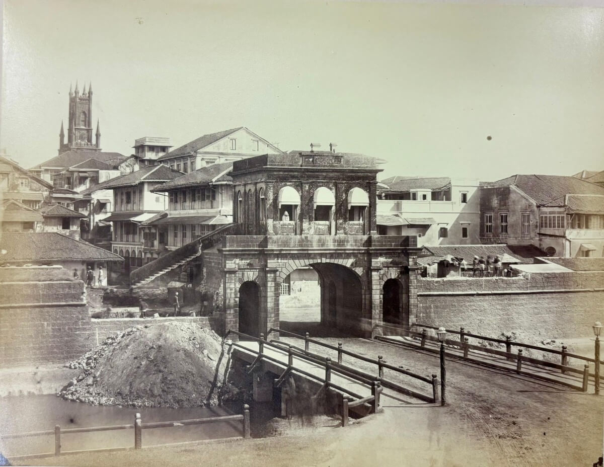
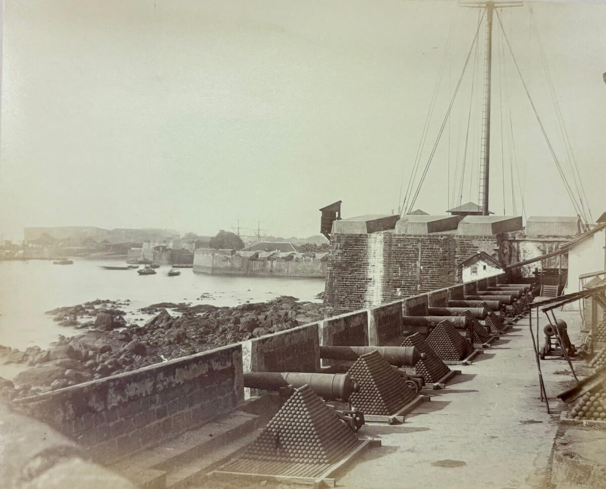
It is important to note that the history of Indian forts and fortifications is intertwined with the rise of foreign powers in the Indian subcontinent, as some forts were the products of European rule. The British, for example, carried out several major fortifications of Bombay after the city fell under British rule through the East India Company in the mid-17th century. In our collection there is an album of photographs of the English Fort of Bombay, a fortification completed by the British in 1716 in present-day Mumbai. Apart from strengthening the defence of this major trading port, the fort in effect functioned as a walled town, encompassing civic structures such as houses, a town hall, a cathedral and other facilities. Having safeguarded the city for nearly 150 years, the fort was dismantled in the early 1860s to accommodate the expansion of the fast-developing city.
The photographs in the album (Photo.10) were taken shortly before the demolition and capture views within the fortified area, such as the entrance gates and other administrative and military structures. It was considered to be a rare visual record of the structure by the photographer Eugene Leggett, as he wrote in his accompanying letter that the photographs ‘are the only representation, the world can now ever have, of what the old Fort of Bombay was like, for I believe no professional photographer or other amateur than myself possesses a series of views of the same.’
I hope the above gives you a taste of the rich legacy of Indian forts and fortifications documented in our collection of visual works. If you are curious about the new inscription of the Maratha military landscapes of India, further information is available at this link: https://whc.unesco.org/en/list/1739. As always, feel free to get in touch if you would like to see or find out more about the items featured in this blogpost!
James Liu